
Maui is home to some of the most diverse hiking trails in Hawaii. The best hikes in Maui take you through lush rainforests, bamboo forests, volcanic craters, and along rugged stretches of coastline.
Whether you’re looking for an easy coastal walk, a waterfall hike, or a challenging trek through Haleakala Crater, this guide covers the best Maui hikes for every type of adventure.

For full transparency, this post contains affiliate links, which means I may earn a small commission if you make a purchase - at no additional cost to you. I only recommend products and services that I genuinely use, trust, or believe will add value to your travels. Your support helps me continue creating free travel guides for you to enjoy.
Why Trust This Best Hikes on Maui Guide?
I lived on Maui for 14 years and personally hiked every trail included in this guide. Hiking was one of my favorite ways to explore the island, from the volcanic landscapes of Haleakala to the rainforests and waterfalls of East Maui.
Throughout this guide, I share my firsthand experience, practical hiking tips, and local insight to help you choose the best Maui hikes for your trip.

Best Hikes in Maui at a Glance
Short on time? These are my top picks and best hikes on Maui.
- Best overall: Pipiwai Trail
- Best views: Waihe’e Ridge
- Best challenging hike: Sliding Sands
- Best easy hike: ‘Ōhai Loop
- Best coastal hike: Kapalua Coastal Trail
🥾 Planning to hike on Maui? Sign up below to get my free Mini Maui Hiking Guide, filled with beautiful trails and helpful tips for exploring the island.

Maui Waterfall Hikes
Maui’s waterfall hikes lead through lush rainforest, bamboo forests, and tropical valleys. From short, family-friendly walks to longer trails, these hikes on Maui showcase some of the island’s most beautiful scenery.


Pīpīwai Trail to Waimoku Falls: Best Overall Hike on Maui
- 💪 Difficulty: Moderately strenuous
- 🥾 Distance: 4 miles round trip
- ⛰️ Elevation Gain: 800 feet
- 📍 Location: Kīpahulu District of Haleakalā National Park
- 🎋 Highlights: Bamboo forest, Makahiku Falls and Waimoku Falls
The Pipiwai Trail to Waimoku Falls combines waterfall views, an enormous banyan tree, and a dreamy bamboo forest, making it my pick for the best overall hike in Maui. The four-mile trail begins in the Kipahulu District of Haleakala National Park and gains about 800 feet in elevation.
About one mile in, boardwalks lead through the bamboo forest before the trail continues to the designated viewing area for 400-foot Waimoku Falls. Stay on the marked trail, obey all closures, and never approach or swim beneath the waterfall due to flash floods and falling rock.
🎋 Read Full Guide: Pipiwai Trail to Waimoku Falls Hiking Guide
Twin Falls
- 💪 Difficulty: Easy
- 🥾 Distance: Varies depending on the waterfall
- 📍 Location: North shore | Mile Marker 2 on the Hana Highway
- 💦 Highlights: Short waterfall hikes and swimming holes
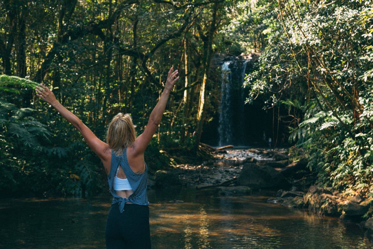
Twin Falls is one of the easiest and most popular waterfall hikes along the Road to Hana. Located on a privately owned farm near Mile Marker 2, a network of short trails leads to several waterfalls and swimming holes.
The lower waterfall is only a short walk from the entrance, while the upper falls require a longer walk and may involve muddy paths or stream crossings. Swimming is only permitted when conditions are safe, so always follow posted signs and avoid the water during heavy rain or flash-flood conditions.
Kūloa Point Trail and the Pools of ‘Ohe’o
- 💪 Difficulty: Easy
- 🥾 Distance: 0.5 Mile-loop
- 📍 Location: Kipahulu District of Haleakala N.P.
- 💧 Highlights: Pools of ‘Ohe’o, ocean views and archaeological sites
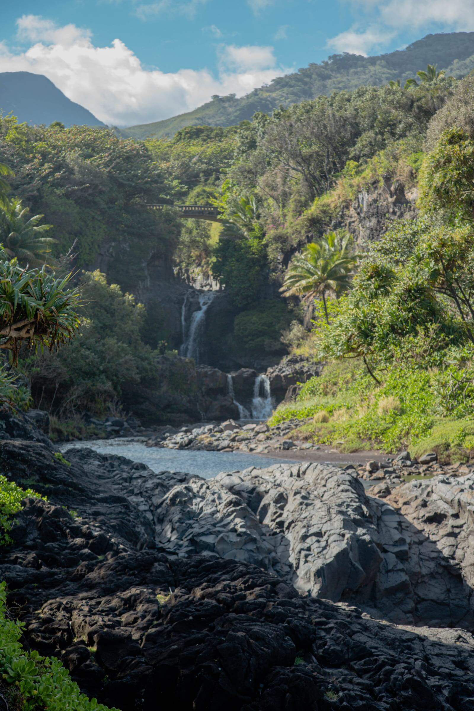
The Kuloa Point Trail is a short loop that leads from the Kipahulu Visitor Center to an overlook of the Pools of ‘Ohe’o. Often called the Seven Sacred Pools, these cascading pools flow through ‘Ohe’o Gulch before reaching the ocean.
Entry and swimming are currently prohibited due to flash floods, falling rocks, and other safety concerns, but you can view the pools safely from the marked trail. Since the trail shares a parking area with the Pipiwai Trail, it’s easy to combine both hikes during the same visit.

Haleakalā National Park Hikes
The hiking trails in Haleakala Crater feel worlds away from Maui’s beaches and rainforests. From short summit walks to strenuous routes across the crater floor, these trails showcase colorful cinder cones, rare native plants, and otherworldly volcanic scenery.
🌋 Planning to visit? Read my complete Haleakala National Park guide for reservations, itineraries, driving directions, and tips for both park districts.

Sliding Sands Trail (Keonehe’ehe’e Trail)
- 💪 Difficulty: Difficult
- 🥾 Distance: Varies, 7.8 miles round trip to the crater floor
- ⛰️ Elevation Gain: 2,500 feet on the return
- 📍 Location: Summit District of Haleakalā National Park
- 🌋 Highlights: Volcanic scenery, cinder cones and Haleakala silverswords
The Sliding Sands Trail, officially called the Keonehe’eh’e Trail, descends from near the summit of Haleakala into a colorful volcanic landscape filled with cinder cones and rare ‘āhinahina, or Haleakala silverswords. The red, orange, purple, and black terrain feels more like Mars than Maui.
You can hike a shorter out-and-back or descend 3.9 miles one way to the crater floor. Remember that the hike begins downhill, leaving the steep, sandy climb and about 2,500 feet of elevation gain for your return.
The altitude, exposure, and unpredictable summit weather make this one of the most challenging hikes in Maui.
🌋 Read Full Guide: Hiking the Sliding Sands Trail
Hosmer Grove
- 💪 Difficulty: Easy
- 🥾 Distance: 0.6 miles
- 📍 Location: Summit District of Haleakala National Park
- 🌲 Highlights: Forest scenery and native Hawaiian birds
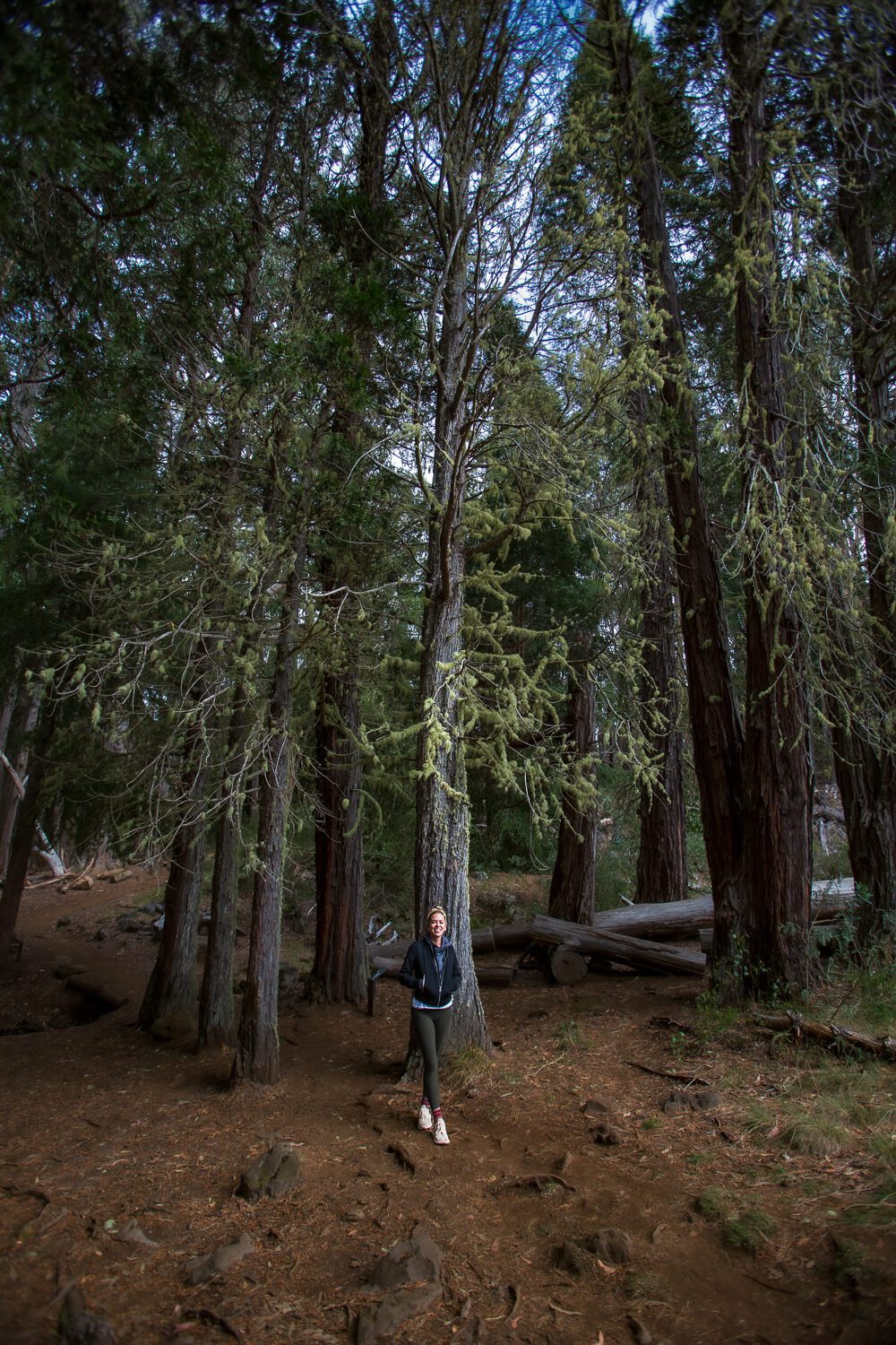
Hosmer Grove is a short, easy loop located near the campground just inside Haleakala National Park. The trail passes through a grove of non-native eucalyptus, pine, cedar, and spruce trees before transitioning into native Hawaiian shrubland.
Hosmer Grove is particularly popular for birdwatching, with opportunities to spot native honeycreepers found nowhere else in the world. Its short distance makes it an easy addition to a day spent exploring the summit area.
🌲 Read Full Post: Hosmer Grove Loop Trail
Supply Trail
- 💪 Difficulty: Moderate
- 🥾Distance: 4.2 Miles roundtrip
- ⛰️ Elevation Gain: 975 feet
- 📍 Location: Haleakala National Park
- ☁️ Highlights: Native shrubland and above-the-clouds views.
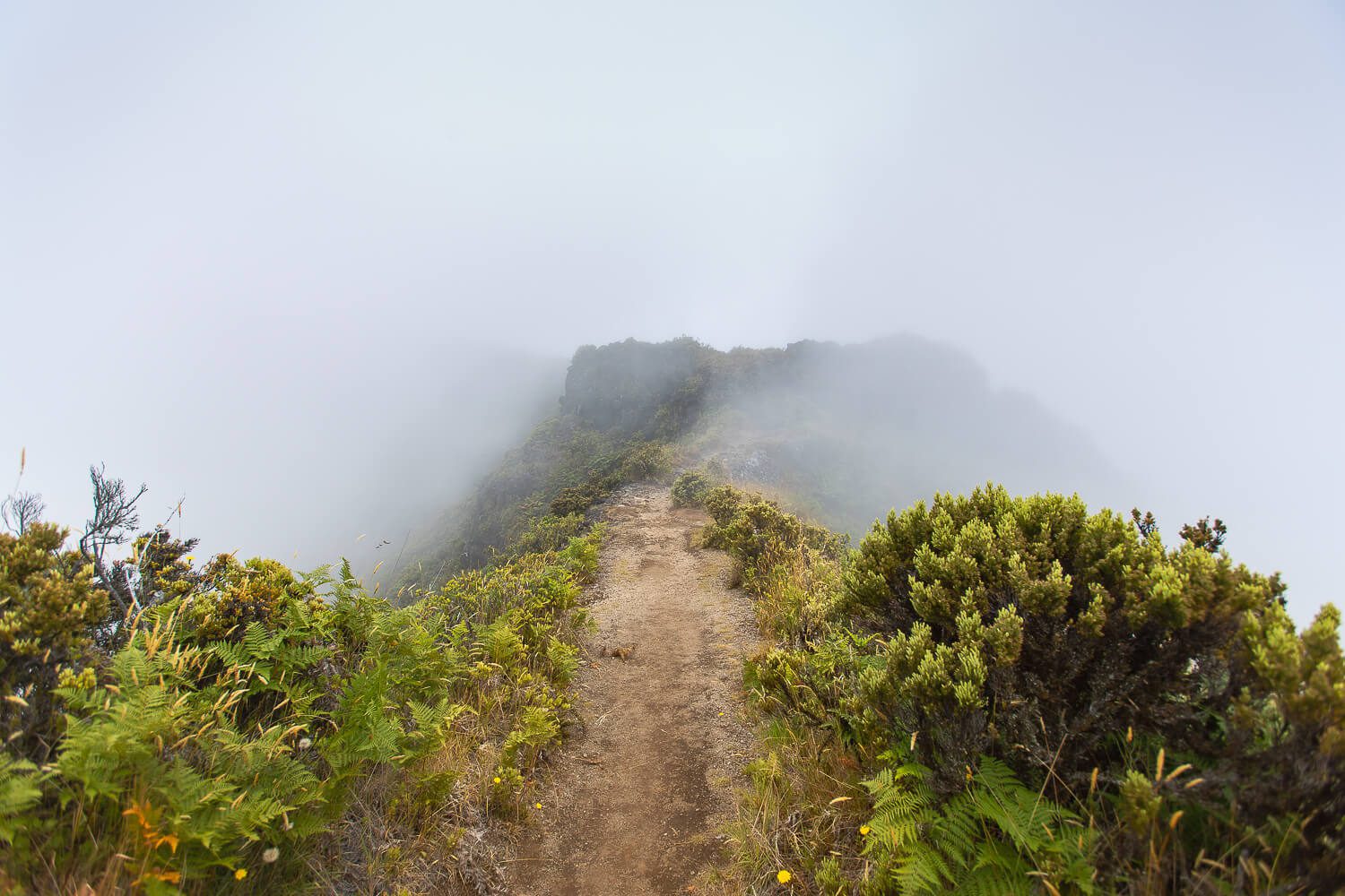
The Supply Trail begins near Hosmer Grove and climbs through the native shrubland of Haleakala’s Summit District. On a clear day, the trail offers expansive views above the clouds without requiring a descent into the crater.
The standard 4.2 mile out-and-back route ends at its junction with the Halemau’u Trail. More experienced hikers can continue toward the crater overlook or descend the Halemauu switchbacks, but doing so will significantly increase the distance and difficulty.
Halemau’u Trail
- 💪 Difficulty: Difficult
- 🥾 Distance: About 7.4 Miles round trip to Hōlua Cabin
- ⛰️ Elevation Gain: 1,050 feet on the return
- 📍 Location: Summit District Haleakalā National Park
- 🪿 Highlights: Crater views, dramatic switchbacks, and Holua Cabin
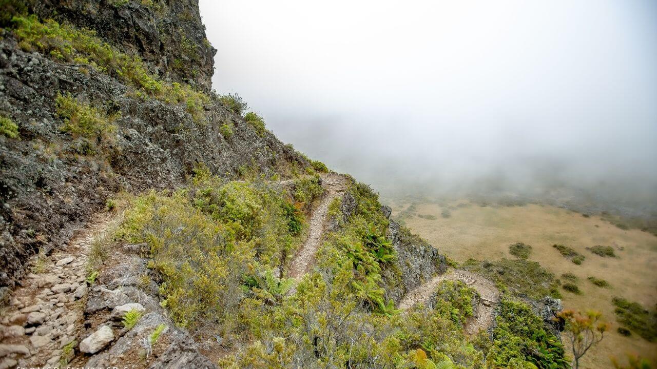
One of my favorite hikes in Maui, the Halemauu Trail descends into Haleakala Crater along a dramatic series of narrow switchbacks. The exposed trail offers sweeping views across the crater, but hikers who are uncomfortable with heights may find this section challenging.
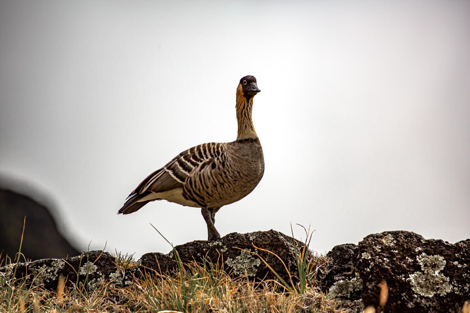
Holua Cabin is about 3.7 miles from the trailhead and makes a good turnaround point for a strenuous day hike. Along the way, look for endemic plants and nene. Hawaii’s native goose. Remember that the return is almost entirely uphill, and the high elevation can make the climb feel more difficult.
🥾 Read Full Guide: Hiking the Halemau’u Trail

West Maui Hikes
West Maui hikes range from dry, exposed ridge lines to shaded forest trails overlooking the coast. These trails offer some of the island’s best views, but conditions can vary considerably depending on elevation, weather, and recent rainfall.
Lahaina Pali Trail
- 💪 Difficulty: Difficult
- 🥾 Distance: 5 miles point to point or up to 10 miles out and back
- ⛰️ Elevation Gain: 1,600 feet
- 📍 Location: West Maui | Ukumehame and Mā’alaea trailheads
- 🌬️ Highlights: Ocean, island and wind-turbine views
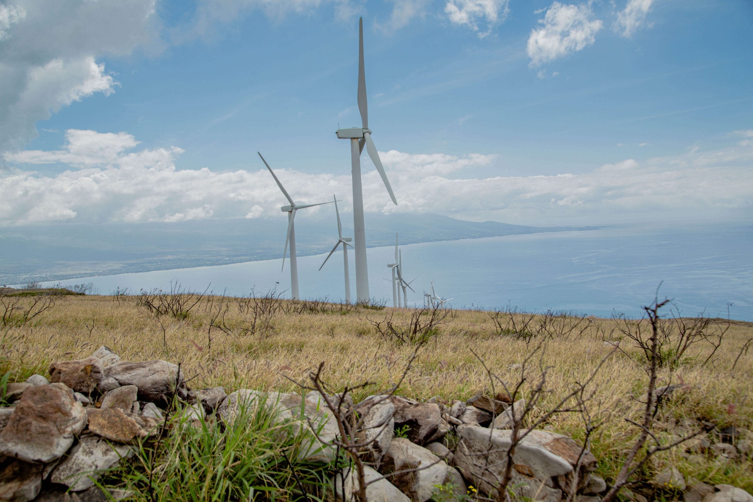
The Lahaina Pali Trail climbs a dry, rocky route to Kealaloloa Ridge, passing beneath towering wind turbines along the way. The exposed trail offers expansive views of the Pacific Ocean, Lāna’i, Kaho’olawe, and the coastline of South Maui.
You can hike from either trailhead as an out-and-back or complete the full five-mile point-to-point route with two vehicles. With 1,600 feet of elevation gain and very little shade, the trail can feel especially strenuous in Maui’s heat. Start early, carry plenty of water, and check current trail conditions before hiking.
🌬️ Read Full Post: Hiking the Lahaina Pali
Mahana Ridge
- 💪 Difficulty: Difficult due to length
- 🥾 Distance: 20+ miles round trip for the complete route; shorter out-and-backs possible
- 📍 Location: West Maui | Kapalua
- 🍍 Highlights: Forest scenery and views into Mokupe’a and Honokahua Gulches
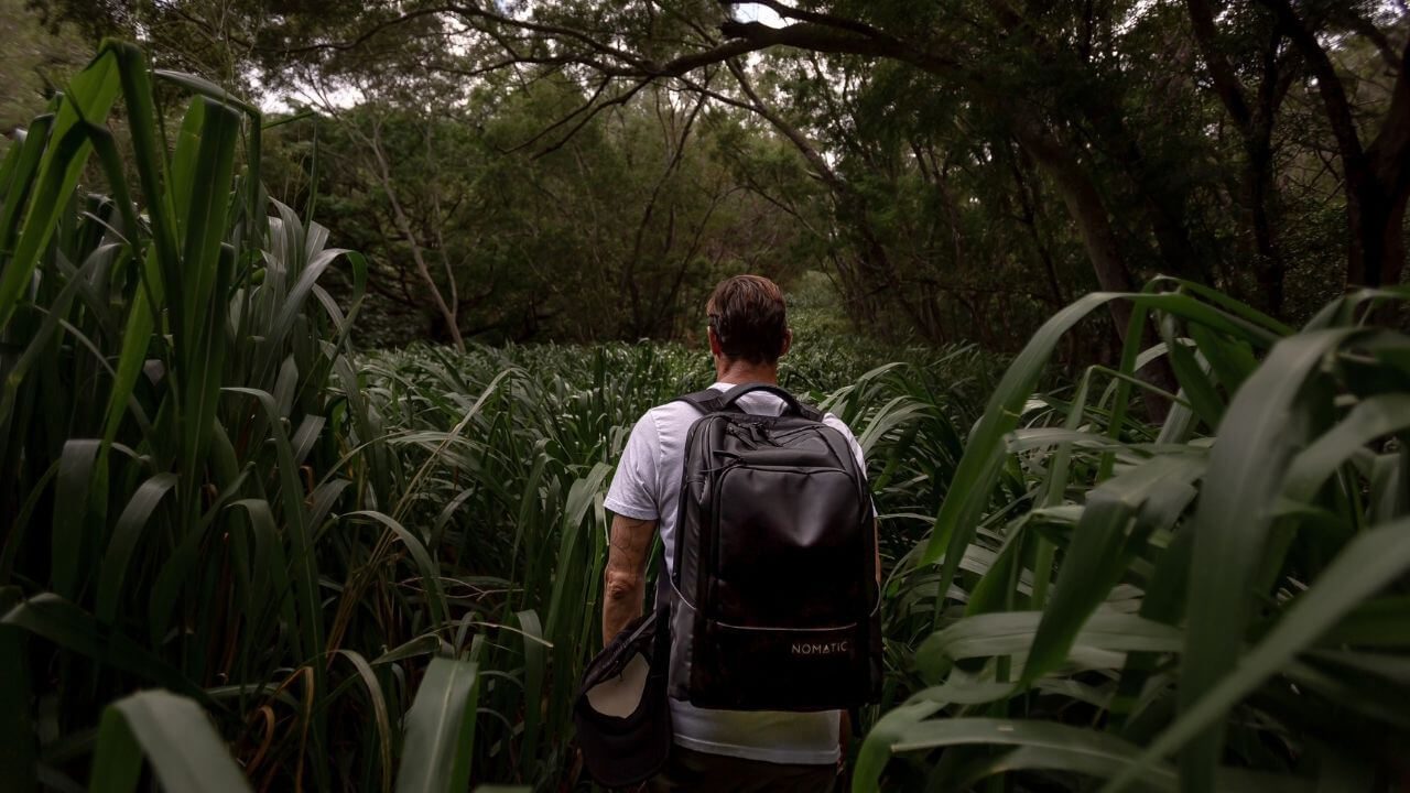
The Mahana Ridge Trail climbs from Kapalua Resort toward Maunalei Arboretum through land once used to grow coffee and pineapple. Along the way, the trail passes through increasingly forested terrain with views into Mokupe’a and Honokahua Gulches.
The complete route is more than 20 miles round trip, making it one of the longest and most strenuous hikes in Maui. You can enjoy a shorter out-and-back by choosing a turnaround point that fits your ability and available time. Start early and don’t rely on the former arboretum shuttle because it no longer operates.
🥾 Read Full Post: Mahana Ridge Hiking Guide
Kapalua Village Walking Trails
- 💪 Difficulty: Moderate
- 🥾 Distance: 4 Mile loop to the duck pond
- 📍 Location: West Maui | Kapalua Village Center
- 🦆 Highlights: Hidden lake, forest paths, and panoramic views
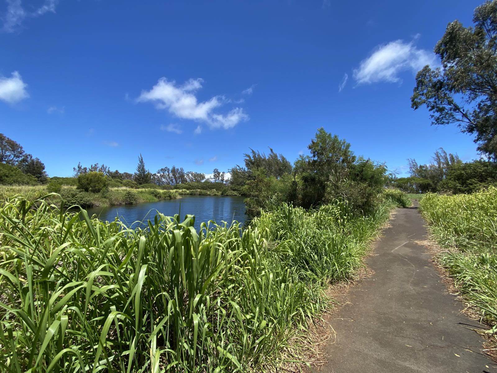
The Kapalua Village Walking Trails follow the paved cart path of the former Village Golf Course. Six interconnected routes climb through quiet, forested sections of Kapalua and offer panoramic views of the coastline and Moloka’i.
One of the most popular routes leads uphill to a hidden lake which locals call the Duck Pond. The trails are generally easy to follow, but some sections are steep enough to provide a good workout. Enjoy the ducks from a distance and avoid feeding them.

Waihe’e Ridge Trail: Best Hike in West Maui
- 💪 Difficulty: Moderate
- 🥾 Distance: 4.8 Miles round trip
- ⛰️ Elevation Gain: 1,500 feet
- 📍 Location: West Maui Mountains | Waihe’e
- 🌴 Highlights: Ridge, valley, waterfall, and coastal views
Waihee Ridge was the first trail I hiked after moving to Maui, and it remains my favorite hike in West Maui. The trail climbs steadily through several forested sections before opening onto a ridgeline with views of Waihe’e Valley, Makamaka’ole Falls, and Maui’s northern coastline.
The final section gains elevation quickly through a series of switchbacks before reaching a picnic table and viewing platform. Clear mornings offer the best views, while clouds and rain can quickly obscure the ridge and make the trail muddy and slippery.
📌 Read Full Post: Hiking the Waihee Ridge Trail

Easy hikes in Maui
Not every Maui hike require a strenuous climb or an entire day on the trail. These easy hikes in Maui include short forest loops, paved paths, and scenic walks that are ideal for families, beginners, or anyone looking for a more relaxed adventure.
Kā’anapali Beach Walk
- 💪 Difficulty: Easy
- 🩴 Distance: Varies, up to 5.5 miles round trip
- 📍 Location: West Maui | Kaanapali
- 🐳 Highlights: Beaches, resort dining, and seasonal whale watching
The Kaanapali Beach Walk is more of a scenic coastal stroll than a traditional hike, but it’s one of the easiest ways to explore West Maui on foot. The mostly paved path passes beaches, landscaped resorts, Whalers Village, and plenty of places to stop for food or a mai tai.
The route has northern and southern sections divided by Pu’u Keka’a, commonly known as Black Rock. Walk as far as you like or combine both sections for a longer outing between Honua Kai Resort and Hanaka’ō’ō Park. The path gets busy, so early morning is best for running or a quieter walk.
🐠 Spending more time in West Maui? These are the Best Things to do in Kaanapali and my favorite Restaurants in Kaanapali.

‘Ōhai Loop Trail
- 💪 Difficulty: Easy
- 🥾 Distance: 1.2 Mile
- 📍 Location: West Maui | Kahekili Highway
- 🌺 Highlights: Sea cliffs, native plants, and seasonal whale watching
The Ohai Loop Trail is a short, scenic hike along the rugged northern coast of West Maui. It makes an easy stop to stretch your legs while driving around West Maui, with sweeping views of the ocean, sea cliffs, and Kahakuloa Head.
The loop is relatively easy, but it has little shade and can be windy, muddy, or slippery depending on the weather. During whale season, keep an eye on the ocean for humpback whales passing offshore.
🍃 Read Full Post: Hiking the Ohai Trail

Waikamoi Forest Ridge Trail
- 💪 Difficulty: Easy
- 🥾 Distance: 0.8 Mile
- 📍 Location: Hana Highway | Near Mile Marker 9
- 🌴 Highlights: Eucalyptus forest, bamboo, and picnic areas
Waikamoi Ridge Trail is a short forest hike located just off the Hana Highway. The loop passes through eucalyptus trees, bamboo, and dense tropical vegetation, making it a convenient place to stretch your legs while driving the road to Hana.
The dirt trail contains exposed roots and can become extremely muddy and slippery after rain. The forest is the main attraction here, so don’t expect the expansive views found on Maui’s ridge and coastal hikes.
‘Īao Valley State Monument
- 💪 Difficulty: Easy
- 🥾 Distance: 0.5 Miles
- 📍 Location: Central Maui
- 🌿 Highlights: Kuka’emoku viewpoint, and ethnobotanical garden
- 🎫 Reservations: Advance entry and parking reservations required for nonresidents.
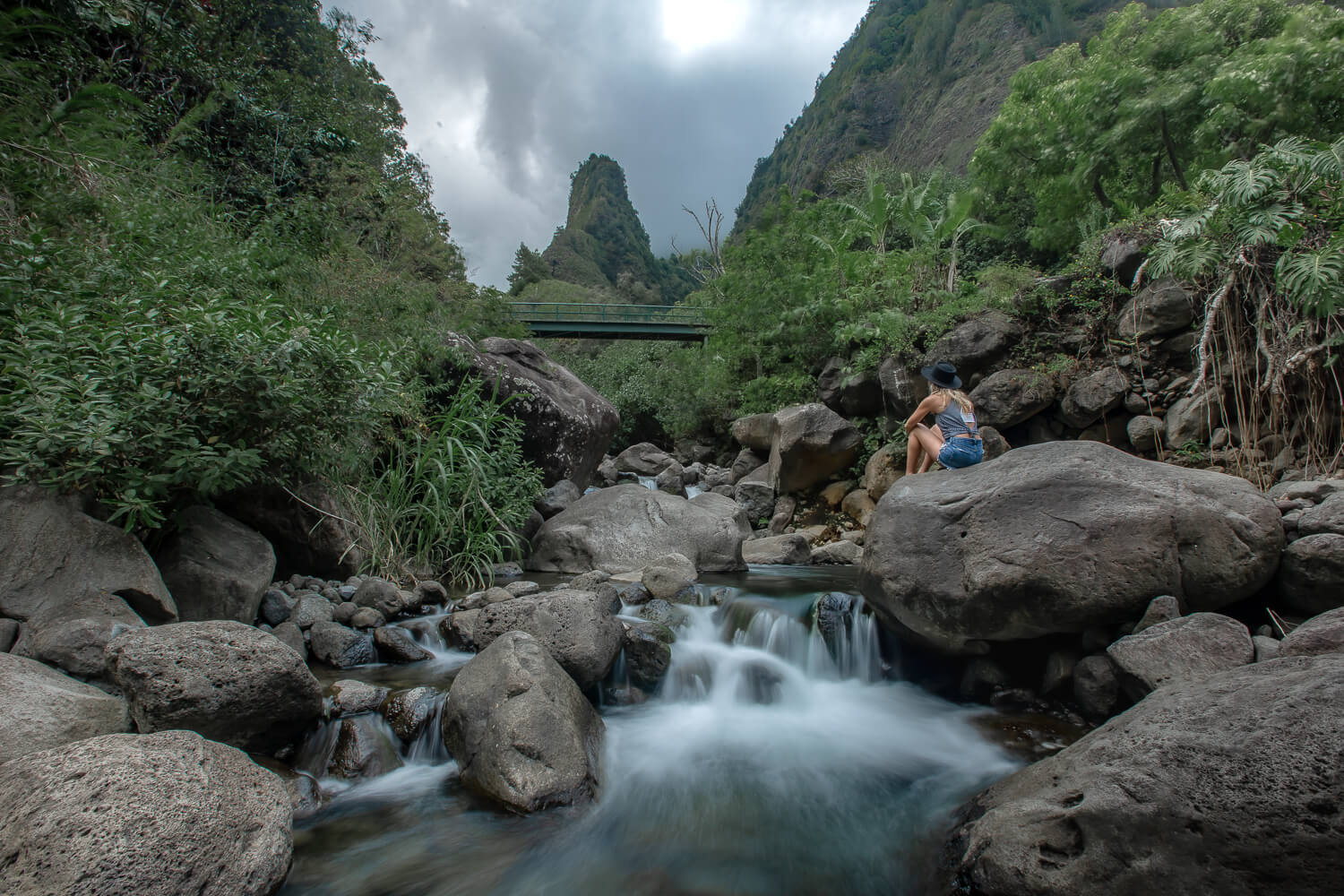
Iao Valley State Park is home to a short, paved trail leading to a viewpoint of Kuka’emoku, commonly called the Iao Needle. Rising 1,200 feet from the valley floor, this dramatic green rock formation is one of Central Maui’s most recognizable landmarks.
The adjoining ethnobotanical loop passes plants introduced and cultivated by Native Hawaiians. Although this is more of a scenic walk than a traditional hike, it’s an easy option for families and visitors interested in Maui’s natural and cultural history.
🌺 Read Full Post: Exploring Iao Valley State Monument
Waihou Spring Trail Loop
- 💪 Difficulty: Easy
- 🥾 Distance: 1.8 Miles
- 📍 Location: Upcountry Makawao
- 🌲 Highlights: Pine Forest
The Waihou Spring Trail Loop is an easy trail located upcountry Maui near Makawao and Pukalani towns. Along the trail you’ll walk through a pine forest.
You’ll eventually come actors the historic Waihou Spring, a natural spring that has been supplying water to the area for centuries. This is a fairly popular Maui hiking trail for local residents so chances are you won’t be alone.
Keep an eye out for Monterey cypress and eucalyptus trees as well as native trees like the alaa, halapepe and koa.

Maui Coastal Hikes
Maui’s coastal hikes combine ocean views with lava fields, beaches, and rugged shoreline scenery. These trails are generally lower in elevation, but the exposed sun, uneven terrain, and limited shade can still make them challenging.

Hoapili Trail
- 💪 Difficulty: Moderate
- 🥾 Distance: 5.5 Miles round trip to Kanaio Beach
- 📍 Location: South Maui | Keone’ō’io Bay, also called La Perouse Bay
- 🐐 Highlights: Historic trail, lava fields, coastal views, and goats
The Hoapili Trail follows a portion of the historic road commonly called the King’s Highway across the rugged lava fields of South Maui. Beginning at Keone’ō’io Bay, the trail traces the coastline toward Kanaio Beach with views of Kaho’olawe and Haleakalā.
Although the route has very little elevation gain, walking across sharp, uneven lava rock makes it more challenging than the distance suggests.
Wear sturdy, closed-toe shoes, start early, and carry plenty of water and sun protection because there is almost no shade. Stay on the marked route and avoid disturbing the archaeological and cultural sites along the trail.
🪨 Read Full Post: Hiking the Hoapili Trail on Maui

Ke Ala Loa O Maui/Pi’ilani Trail (Wai’ānapanapa Coastal Trail)
- 💪 Difficulty: Moderate
- 🥾 Distance: 3 miles round trip
- 📍 Location: East Maui | Waianapanapa State Park
- 🌴 Highlights: Lava coastline, native hala trees, and offshore islets
- 🎫 Reservations Required, book here.
The Ke Ala Loa O Maui/Pi’ilani Trail follows the rugged coastline southeast from Wai’ānapanapa State Park. The three-mile route crosses barren lava rock with views of the Hāna Coast, Haleakalā’s slopes, native hala trees, and small offshore islets.
The trail passes the park cabins and several culturally significant sites before ending at a boulder beach. Stay on the marked route and outside gravesites identified by low stone walls and platforms.
👉 This is an especially convenient hike if you’re staying in the Wai’ānapanapa Cabins. Read my complete Wai’anapanapa State Park guide for reservation information, the black sand beach, hiking, camping, and more.

Kapalua Coastal Trail
- 💪 Difficulty: Easy
- 🥾 Distance: About 2 miles one way
- 📍 Location: West Maui | Kapalua
- 🐠 Highlights: Beaches, rocky coastline, and views of Moloka’i
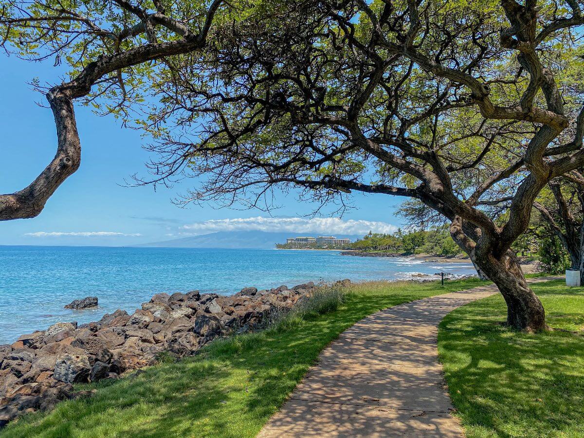
The Kapalua Coastal Trail follows the shoreline from Kapalua Bay to D.T. Fleming Beach, passing Oneloa Bay and several of Maui’s best beaches along the way. The route combines paved paths, wooden boardwalks, and sections of rocky coastal trail.
With almost constant ocean views and several access points, you can walk the full route or explore a shorter section. It’s especially beautiful in the morning and during whale season, when you can spot humpbacks offshore.
🤿 Read Full Post: Hiking the Kapalua Coastal Trail
Maui Hikes I Don’t Recommend
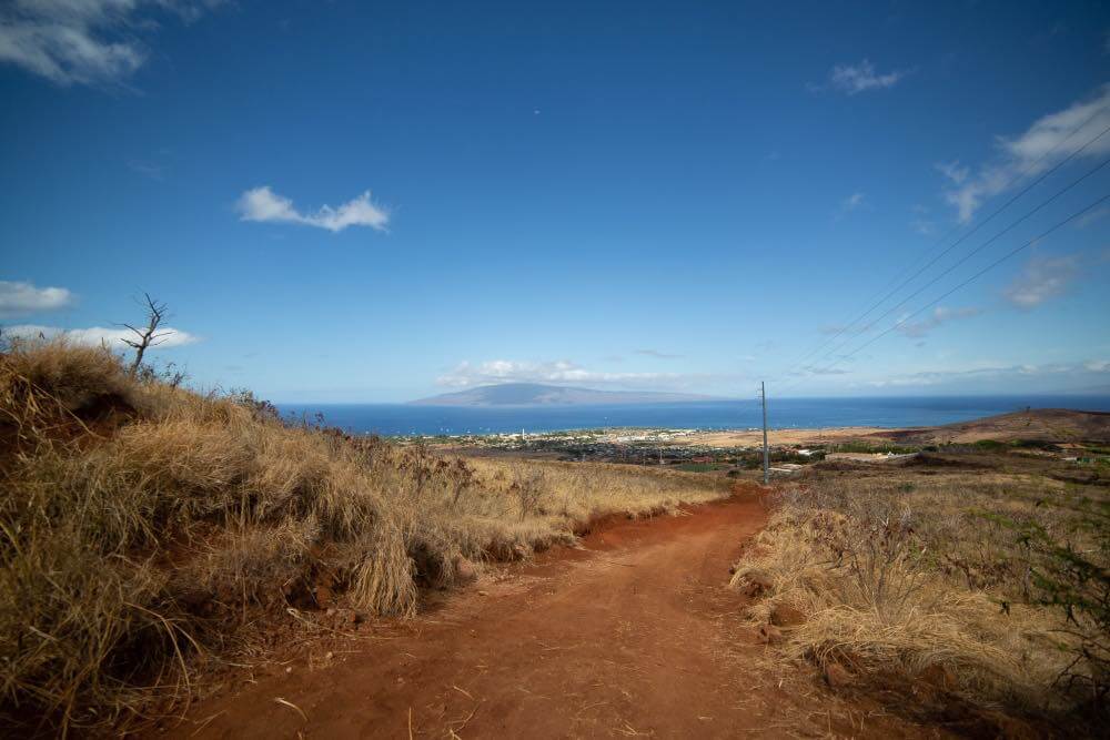
Not every well-known Maui hike is legal or safe to explore. Although you may see the Lahaina “L” and Olivine Pools recommended elsewhere, I no longer include them among the best hikes in Maui.
- The trail leading to the Lahaina “L” crosses private property with posted no-trespassing signs and is not listed as an authorized public trail. Without clear permission from the landowner, I do not recommend attempting this hike.
- The Olivine Pools are reached by descending steep, jagged lava rock beside an unpredictable stretch of ocean. Rogue waves have swept visitors from the pools, resulting in serious injuries and fatalities. Because it is not a maintained trail and state officials do not want to encourage increased visitation, I no longer recommend hiking down or entering the pools.
Maui Hiking Tips & Safety
Maui’s heat, microclimates, rugged terrain, and remote trailheads can make even a short hike more challenging than expected. Keep these Maui hiking tips in mind before heading out.
- 🚰 Carry plenty of water. Many trails are hot, humid, and exposed, with no water available at the trailhead. Start early and bring more water than you expect to need, especially on longer coastal and lava-field hikes.
- 🌊 Take flash floods seriously. Heavy rain in the mountains can cause streams and waterfalls to flood even when the weather looks clear where you are. Never enter closed streams or pools, approach the base of a waterfall, or continue past posted warning signs.
- 🌋 Prepare for Haleakala’s altitude. Summit trails begin between 8,000 and 10,000 feet above sea level. Move slowly, watch for headaches, dizziness, nausea, or shortness of breath, and remember that trails beginning downhill require a strenuous climb back out. Bring warm layers and rain protection because summit weather can change quickly.
- 🥾 Wear shoes with good traction. Maui trails can include sharp lava rock, loose volcanic cinder, exposed roots, mud, and slippery boardwalks. Closed-toe hiking shoes are a better choice than sandals for nearly every trail in this guide.
- 👉 Stay on legal, marked trails. Do not cross private property, pass no-trespassing signs, or follow unofficial social trails. Remaining on designated routes also protects native plants, archeological sites, and culturally significant areas.
- 🅿️ Use designated parking areas. Never block gates, roads, or driveways, and don’t park along the highway where parking is prohibited. Leave valuables out of sight and continue to another stop if a trailhead lot is full.
- ♻️ Respect the land and wildlife. Pack out everything you bring, avoid feeding wildlife, and give nēnē and other animals plenty of space. Leave rocks, plants, and cultural artifacts exactly where you found them.
- ✔ Check conditions before leaving. Trail access can change because of storms, fire danger, flooding, or maintenance. Check Hawaii State Parks or Haleakala National Park, depending on who manages the trail.
Maui Travel Vlogs
Want to see more of Maui? Joe and I filmed many of our adventures around the island, including several of the hikes featured in this guide.
🎥 Watch our Maui series on YouTube, and subscribe to follow more of our adventures.

Final Thoughts on the Best Hikes in Maui
The best hikes in Maui showcase just how diverse the island is, from the bamboo forest of the Pipiwai Trail and the volcanic landscape of Haleakala to the ridge lines and rugged coastline of West Maui.
Whether you want an easy coastal walk or a challenging trek into the crater, there’s a Maui hike for every type of adventure. If you’ve completed any of these trails – or have another favorite – let me know in the comments below 👇.
More Maui Travel Guides ↓
📍 Planning a trip to Maui? Check out these guides for more inspiration and tips to plan your travels.
Enjoy this Post?!?! Pin in for Later ↓